To allow for development on parkland that is intended to serve educational, recreational, and community needs at the city-wide, district, and neighbourhood level.
Community Uses |
|
| 2.1. | Child Care Service |
| 2.2. | Community Service, excluding Year-round Shelter |
| 2.3. | Library |
| 2.4. | Outdoor Recreation Service |
| 2.5. | Park |
| 2.6. | Protected Natural Area |
| 2.7. | School |
| 2.8. | Special Event |
Basic Service Uses |
|
| 2.9. | Transit Facility |
Commercial Uses |
|
| 2.10. | Food and Drink Service, limited to those existing as of January 1, 2024 |
| 2.11. | Major Indoor Entertainment, limited to those existing as of January 1, 2024 |
| 2.12. | Minor Indoor Entertainment, limited to those existing as of January 1, 2024 |
Agricultural Uses |
|
| 2.13. | Urban Agriculture |
Sign Uses |
|
| 2.14. | Fascia Sign |
| 2.15. | Freestanding Sign |
| 2.16. | Minor Digital Sign |
| 2.17. | Portable Sign |
| 2.18. | Projecting Sign |
Community Uses |
|||||
| 3.1. | Community Services in the form of a Religious Assembly must not be developed as a standalone building. | ||||
| 3.2. | Child Care Services must comply with Section 6.40. | ||||
| 3.3. | Special Events must comply with Section 6.100. | ||||
Basic Service Uses |
|||||
| 3.4. | Transit Facilities | ||||
|
|||||
Agriculture Uses |
|||||
| 3.5. | Urban Agriculture must only be developed in conjunction with, or on the same Site as, an existing Community Service or Park Use. | ||||
Sign Uses |
|||||
| 3.6. | Fascia Signs, Minor Digital Signs and Projecting Signs are limited to On-premises Advertising. | ||||
| 3.7. | Freestanding Signs and Portable Signs with Off-premises Advertising are limited to Copy advertising for Community Uses. | ||||
| 3.8. | Signs must comply with Section 6.90. | ||||
Accessory Uses |
|||||
| 3.9. | The maximum Floor Area for Commercial Uses Accessory to a Transit Facility is 150 m2 per individual establishment. | ||||
| 4.1. | Development must comply with Table 4.1: |
| Table 4.1. Site and Building Regulations | |||
|---|---|---|---|
| Subsection | Regulation | Value | Symbol |
| Height | |||
| 4.1.1. | Maximum Height | 16.0 m | - |
| Setbacks | |||
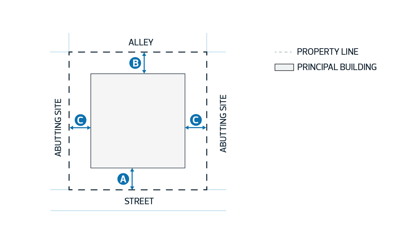
| 4.1.2. | Minimum Setback Abutting a Street | 6.0 m | A |
| 4.1.3. | Minimum Setback Abutting an Alley | 4.5 m | B |
| 4.1.4. | Minimum Setback Abutting a Site | 4.5 m | C |
|
Diagram for Subsections 4.1.2 - 4.1.4 
|
|||
| 4.2. | Despite Subsection 6.1 of Section 7.100, the Development Planner may vary the maximum Height where necessary to accommodate features essential to the Use. | a |
Parking, Loading and Waste Collection Requirements | |||||
| 5.1. | Surface Parking Lots and loading, and waste collection areas must not be located within a required Setback Abutting a Street or another Site. | ||||
Additional Information Requirements | |||||
| 5.2. | Where this Zone Abuts the A Zone or NA Zone, or is located within the North Saskatchewan River Valley and Ravine System Protection Overlay, the Development Planner, in consultation with the City department responsible for ecological planning: | ||||
| |||||
