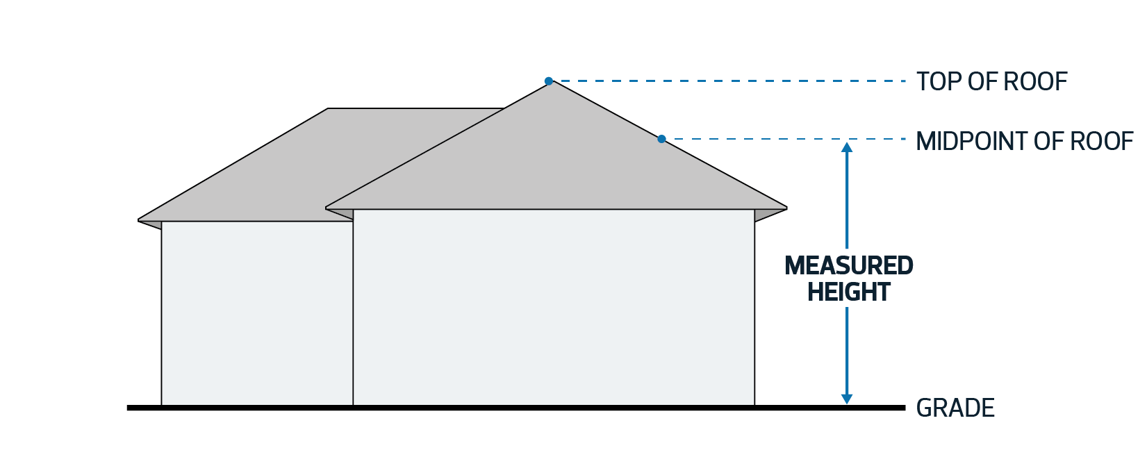
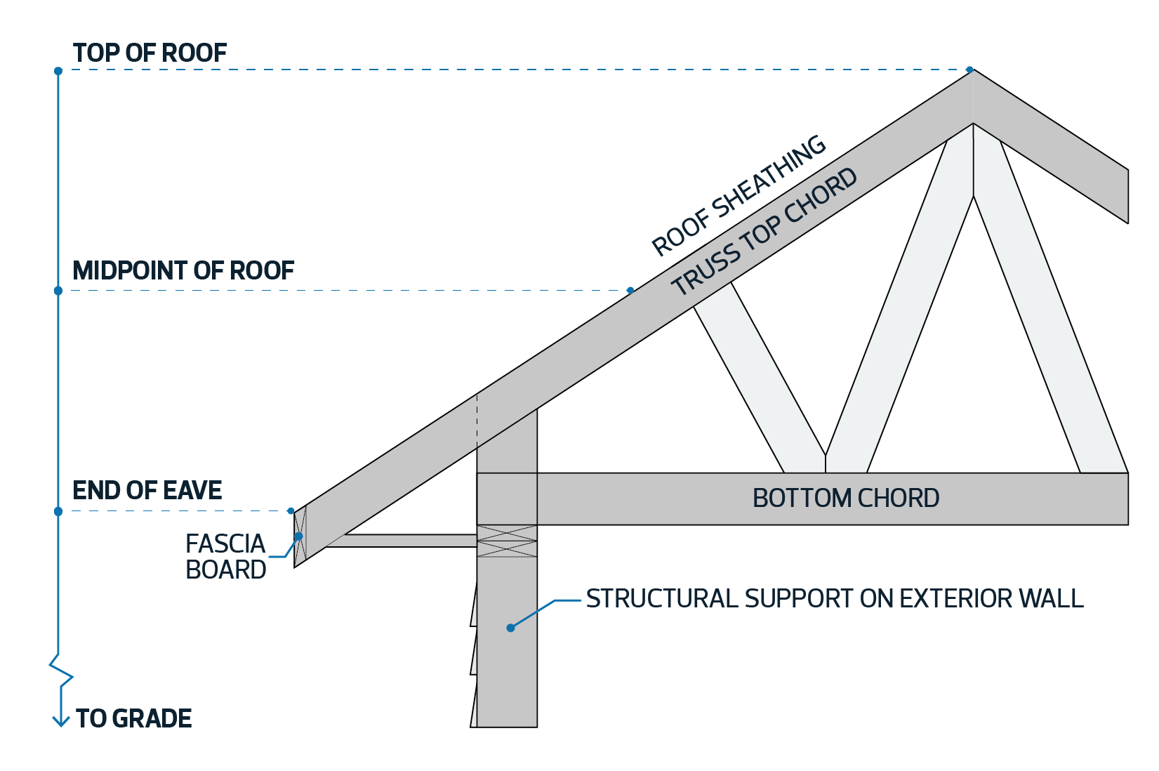
| 1.1. | The Height of a building with a hip or gable roof is measured from Grade to the midpoint of the highest roof. The midpoint of a roof is determined to be between the end of the eave (intersection of the fascia board and the top of the roof sheathing) and the top of the roof. |
| 1.2. | Despite Subsection 1.1, where the side of a roof contains one or more Dormers and the combined width of the Dormers is wider than 1/3 of the width of the building wall underneath the Dormers, the maximum Height of the roof of the building must be measured to the midpoint of the roof of the Dormers. |
| | Diagram for Subsection 1.1
|
|
Mansard or Gambrel Roofs |
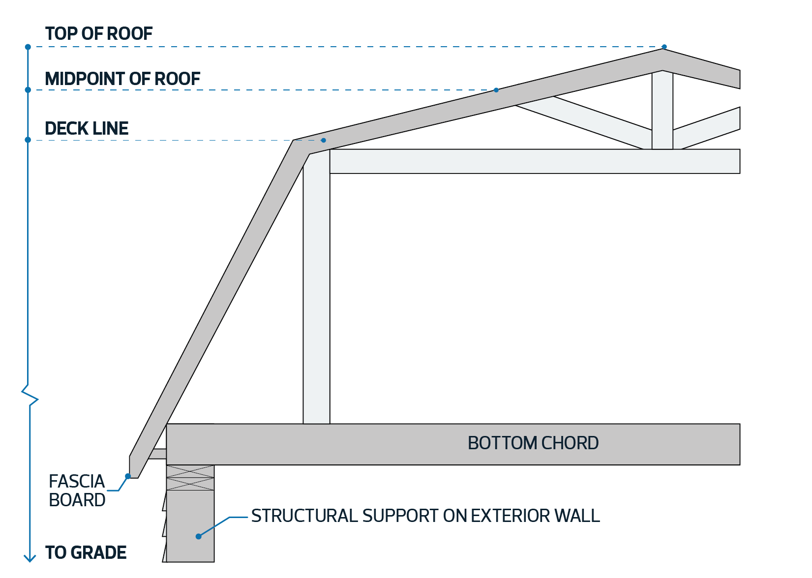
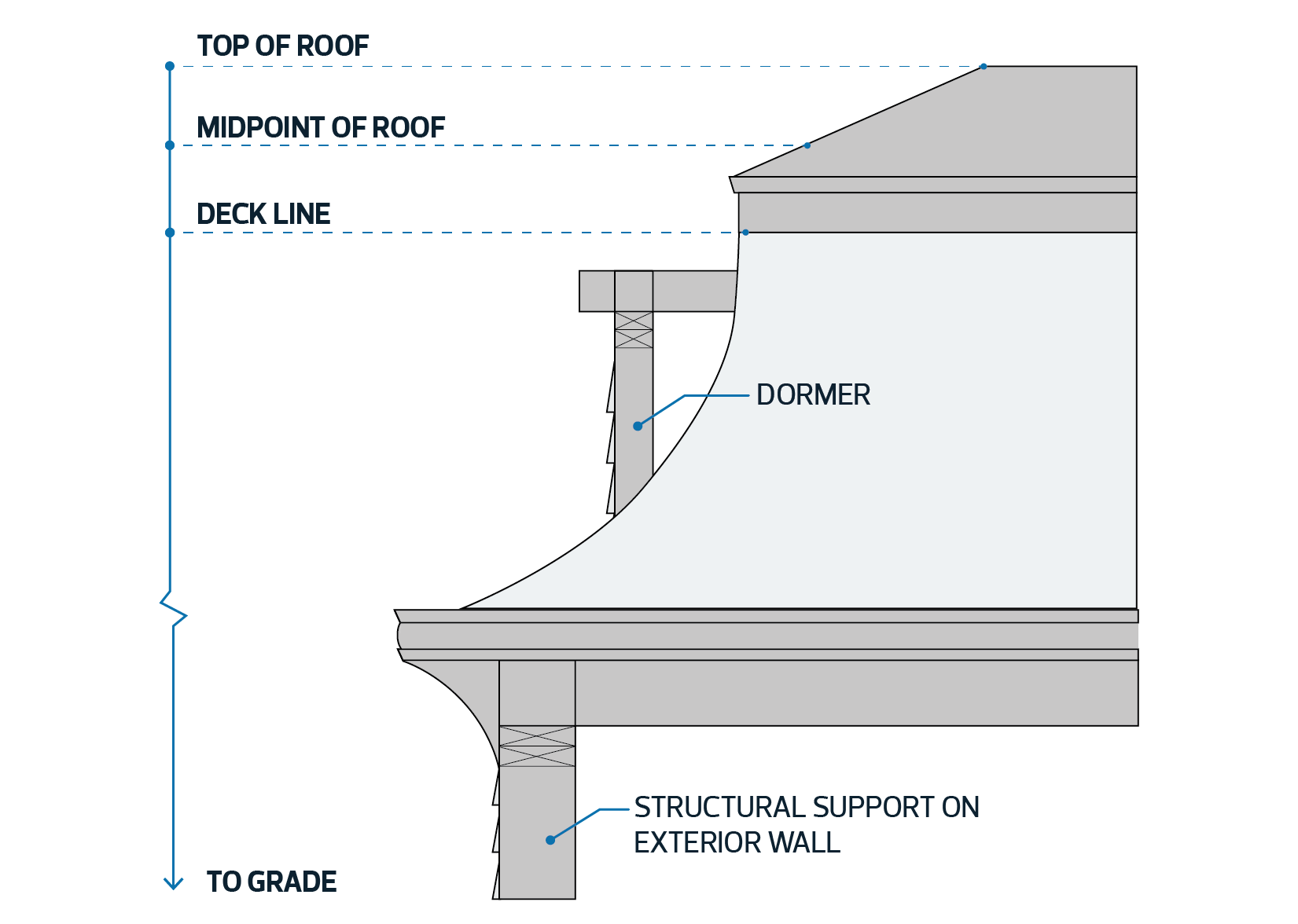
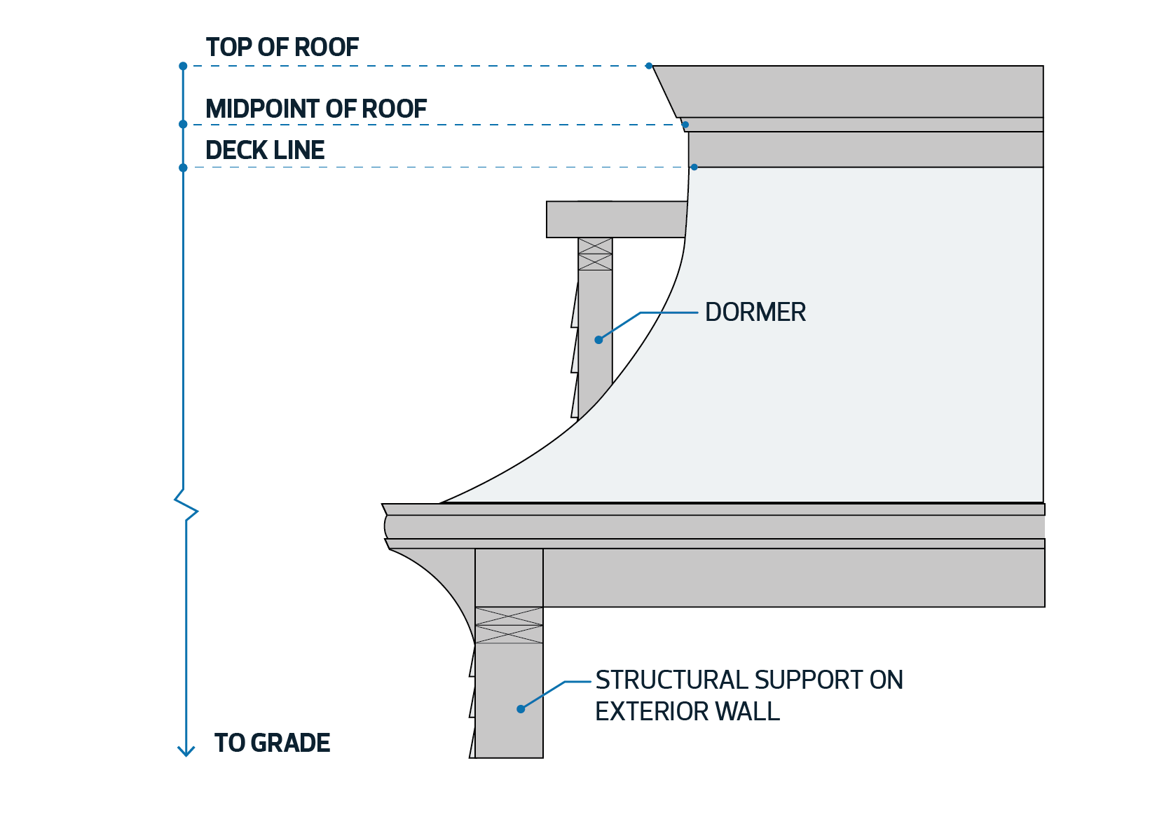
| 1.3. | The Height of a building with a mansard or gambrel roof is measured from Grade to the midpoint of the highest roof. The midpoint of a roof is determined to be between the deck line and the top of the roof. |
| | Diagrams for Subsection 1.3
|
|
Flat Roofs |
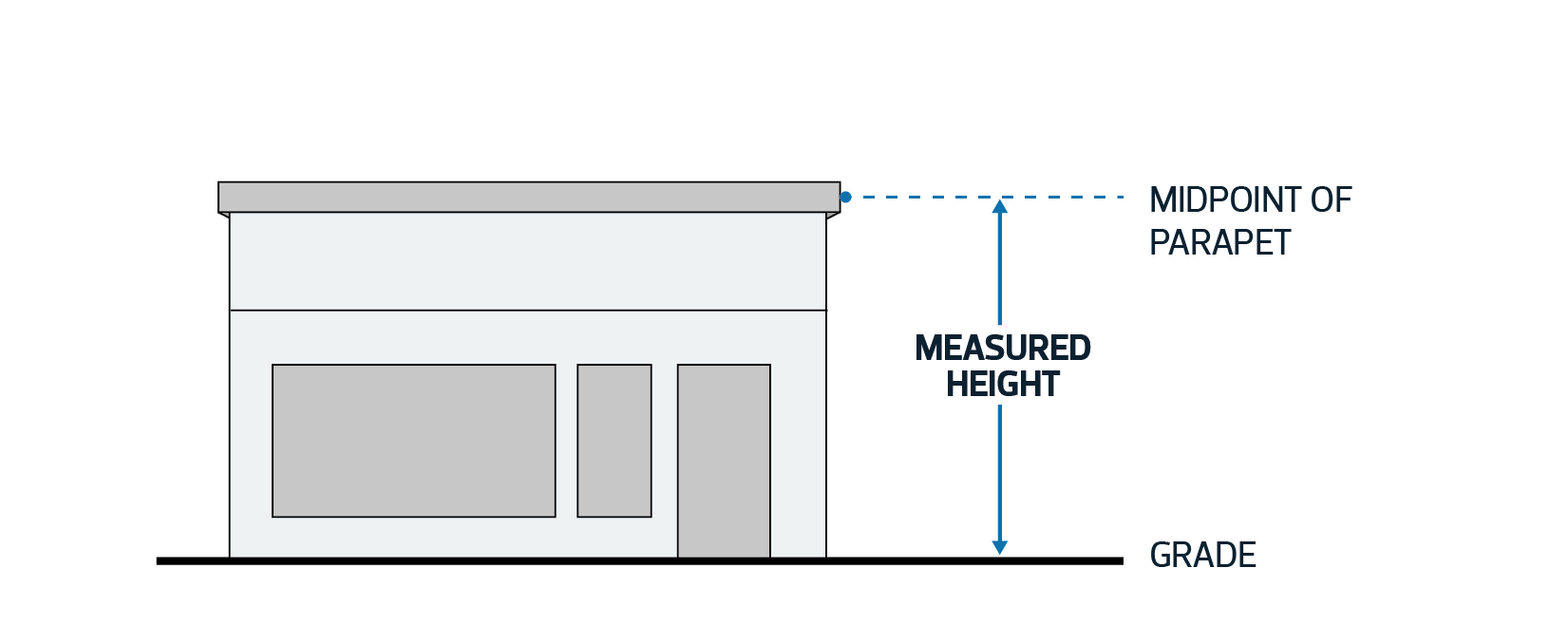
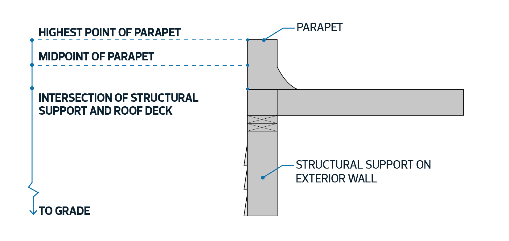
| 1.4. | The Height of a building with a flat roof is measured from Grade to the midpoint of the highest parapet. The midpoint of a parapet is determined to be between the top of the roof deck and the top of the parapet. |
| | Diagram for Subsection 1.4
|
|
Other Roof Styles |
| 1.5. | For all other roof styles, such as |
| | | 1.5.1. | saddle, | | 1.5.2. | dome, | | 1.5.3. | dual-pitch, | | 1.5.4. | shed, | | 1.5.5. | butterfly, and | | 1.5.6. | buildings with a combination of different roof styles, |
|
| | the Development Planner must determine the Height of a building by applying 1 of the methods specified in Subsection 1.1 to 1.4. The chosen method must balance development rights with the land use impact on adjacent properties. |
Other Structures |
| 1.6. | For Platform Structures and unenclosed steps, including landings, Height is measured from the lowest point at ground level to the top of the structure, excluding rails and artificial embankments. |
Height Exemptions |
| 1.7. | The top of a roof is permitted to extend a maximum of 1.7 m above the maximum Height permitted in the applicable Zone. |
| 1.8. | Despite Subsection 1.7, the top of the parapet for a flat roof is only permitted to be a maximum of 0.4 m above the maximum Height permitted in the applicable Zone. |
| 1.9. | The following building structures or features have no Height limit in any Zone: |
| | | 1.9.1. | free-standing or roof mounted chimney stacks, | | 1.9.2. | steeples, belfries, domes, spires, minarets, and monuments, | | 1.9.3. | elevator housing and roof stairways, | | 1.9.4. | water or other tanks, | | 1.9.5. | ventilating equipment, plumbing stacks, and mechanical penthouse, | | 1.9.6. | skylights. | | 1.9.7. | fire walls, | | 1.9.8. | antenna structures and satellite dishes, | | 1.9.9. | masts, flag poles, and clearance markers, or | | 1.9.10. | other similar architectural features. |
|
| 1.10. | Despite Subsections 1.8 and 1.9, buildings in a residential Zone with a maximum Height of 12.0 m or less may have a rooftop enclosure provided for a stairway, elevator housing and associated landing area used only to access the Rooftop Terrace. The top of the enclosure must not be more than 3.0 m above the maximum Height of the Zone. |
| | | 1.10.1. | A landing area within the rooftop enclosure must have: | 1.10.1.1. | a maximum width equal to the width of the associated stairway and elevator; and | | 1.10.1.2. | a maximum length equal to 1.8 m plus the length of the associated stairway and elevator. |
| a | | 1.10.2. | Rooftop stairways, elevator housings and associated landing areas must use design techniques such as stepbacks, roof styles, or other techniques to reduce perceived building mass. | | | | Diagram for Subsection 1.10.1

|
| a |
|
